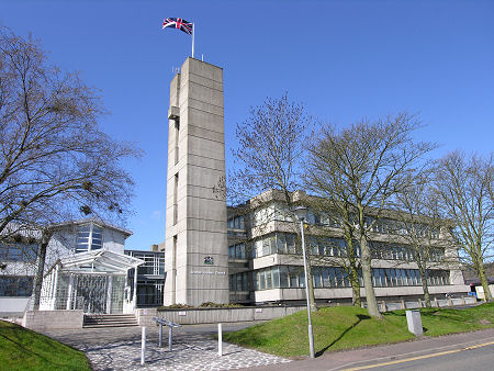
 Scottish Borders Council Offices, Newtown St Boswell |
Scottish Borders is one of the 32 unitary council areas into which Scotland has been divided since 1996. Before that it was also one of the 12 regions into which the country was divided from 1975 to 1996. In terms of physical size, Scottish Borders is the 6th largest of Scotland's unitary council areas. It is only the 18th largest in terms of population, reflecting the largely rural nature of the area. For accommodation in the Scottish Borders and a full list of features, see our Scottish Borders area pages.
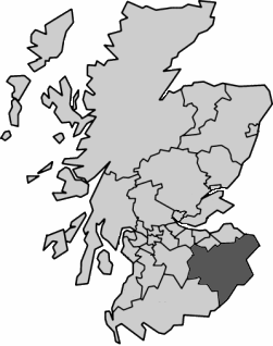
 Scottish Borders Since 1996 Note About Image Copyright |
The Scottish Borders extend from the North Sea coast north of Berwick-upon-Tweed in the east, to Annanhead Hill, only a mile and a half from the M74 motorway, in the west. Travelling south to north it extends from near Canonbie to the spine of the Pentland Hills and to the North Sea at Cockburnspath.
Scottish Borders is bordered to its west by Dumfries & Galloway and South Lanarkshire; and to its north by West Lothian, City of Edinburgh, Midlothian and East Lothian.
Historically, the phrase "Scottish Borders" was applied to the whole of the border between Scotland and England, and to the areas on both sides of it, though the alternative term "Scottish Marches" was often used. These were divided into an East March, a Middle March and a West March in Scotland, and a mirroring set of Marches in England. Between bouts of periodic open warfare that ravaged the area for over five centuries until the late 1600s, the area was a happy hunting ground for cross-border feuds and banditry by border reivers. The East March in Scotland eventually became the traditional county of Berwickshire, and the Middle March became the traditional county of Roxburghshire.
A particular bone of contention between Scotland and England was Berwick-upon-Tweed. On the north bank of the River Tweed and the county town of the traditional Scottish county of Berwickshire, it was logically Scottish. But logic played little part in the politics of the day and in the two centuries up to 1482 the town changed hands no fewer than 14 times. Since then it has remained a part of England.
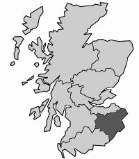
Fast forward to a major reorganisation of 1975, and the name "Scottish Borders" was first applied to a local government area when it became one of the 12 regions into which Scotland was divided. This took over the areas of the traditional counties of Berwickshire, Roxburghshire, Selkirkshire and Peeblesshire.
As a region, Scottish Borders was the upper of two tiers of local government. The lower tier comprised four district councils: Tweeddale which was formed from the traditional county of Peeblesshire; Ettrick & Lauderdale, which was formed from Selkirkshire with the addition of parts of Roxburghshire and Berwickshire; Berwickshire District, which was formed from the remainder of the county of Berwickshire; and Roxburgh, which was formed from most of Roxburghshire.
In 1996, another major reorganisation swept regions away, replacing them with 32 unitary councils. Scottish Borders became one of those councils. It divides its coverage into five area committee areas. Three of these retained the boundaries of three of the district council areas, with Berwickshire formed from Berwickshire District; Eildon formed from Ettrick & Lauderdale District; and Tweeddale formed from Tweeddale District. What had been Roxburgh District was split between two area committee areas: Cheviot, and Teviot & Liddesdale.

|
|
|
InformationScottish Borders Council:www.scotborders.gov.uk |
 Scottish Borders, 1975-1996 Note About Image Copyright |