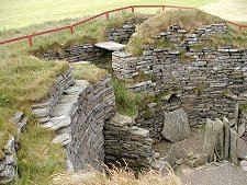
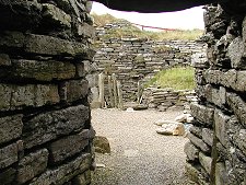
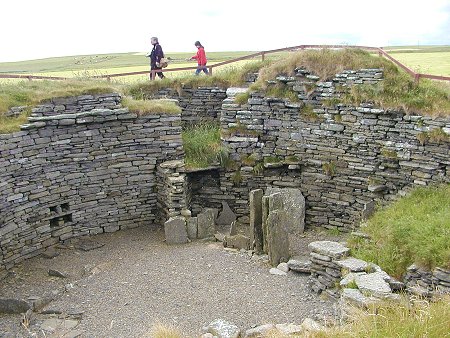
 View over the Broch |
About a mile south of the Ness of Ork on Shapinsay a narrow side road signposted to Burroughston Broch leads south-east to a parking area large enough for a few cars. From here a grassy path leads between a fence and a bank of wild flowers a couple of hundred yards to the grassy mound that surrounds the broch itself.
For collectors of brochs, Burroughston is slightly out of the ordinary. First, being at the quiet end of a quiet island, you are unlikely to find it overrun with other visitors. This gives you the opportunity to get a feel for the slightly informal and overgrown atmosphere of the place. You can never quite convince yourself that you have actually discovered the broch for yourself, but it is nice to come across it in this semi-natural condition.
The second thing that sets Burroughston apart from somewhere like the Broch of Gurness or Midhowe Broch is that only the interior of the broch has been excavated. This allows you to look down into the structure from the surrounding mound. The walls themselves rise to the better part of 3m or 10ft, and as is usual of such structures a staircase has been inserted into the thickness of the wall.
Within the broch are the slight remains of fixtures and fittings like those seen at somewhere like Gurness, plus storage compartments built into the wall. The centre of the broch has a modern metal grille covering a hole in the ground that might have been a well, but which also bears a close resemblance to the steps leading down into Mine Howe on Mainland. In the entrance passage a low passage leads off to one side into a cavity within the wall that offers a fine corbelled roof, interestingly also very reminiscent of workmanship at Mine Howe.
Burroughston Broch was excavated in 1861 by George Petrie and Sir William Dryden, names that occur repeatedly in the history of archeology in Orkney. They were, as elsewhere in Orkney, assisted by David Balfour, who owned Shapinsay (as well as Mainland sites like Maeshowe). Having excavated the interior of the broch Petrie and Dryden moved on to other ventures. Over the following 130 years Burroughston Broch slowly filled with rubble and vegetation and it became clear that the walls were in danger of collapsing. Work was undertaken in 1994 to clear out the broch and consolidate the walls, and the result is what you see today.
No visit to Burroughston Broch is complete without exploring the coastline immediately to its south. The flat rocks here provide some of the best seal viewing opportunities on Shapinsay.

|
|
|
Visitor InformationView Location on MapGrid Ref: HY 540 210 What3Words Location: ///tumblers.zone.trying |
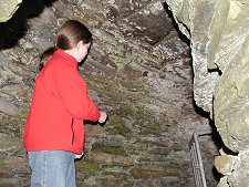 Room Within the Wall |
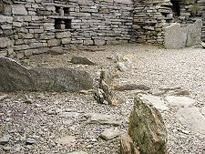 Remains of Furniture |
