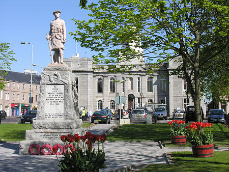
 Inverurie War Memorial and Town Hall |
Inverurie is a prosperous Aberdeenshire town whose history stretches back well over a thousand years. At first sight you might expect its story to be one of quiet and steady commerce and growth. Appearances can be deceptive. Inverurie lies in a strategically important location on the north bank of the River Don, opposite Port Elphinstone, and on the west bank of the River Urie. As a result it has seen conflict more than once in its history.
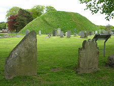
The two rivers meet at the south-east corner of the town, and here you find the site of The Bass, the Earl of Garioch's motte and bailey built in the 1100s. This was used as a base by Robert the Bruce before his defeat of the Earl of Buchan in May 1308 at the Battle of Inverurie, often known - because it was fought several miles north-east of Inverurie near the Hill of Barra - as the Battle of Barra. The motte and bailey of The Bass remain to an impressive height today, and now share a large cemetery with a fascinating group of Pictish symbol stones.
Inverurie lends its name to not one but two battles. The second took place over four centuries after the first, on 23 December 1745, when 1,100 Jacobites defeated 500 Hanoverian troops in what was to be the third-last battle to be fought on British soil. A cairn on the bank of the River Don today marks the site of the battle.
These two Battles of Inverurie neatly bracket in history the largest and most important conflict to have taken place in Aberdeenshire. On 24 July 1411 an advancing army of Highlanders under Donald, Lord of the Isles were fought to a standstill by a rapidly gathered army of Lowlanders under the Earl of Mar at the Battle of Harlaw, two miles north of Inverurie. The battle was one of the most savage and bloody to be fought on Scottish soil, and today its site is marked by a large memorial erected to commemorate the 500th anniversary of the battle.
Inverurie itself grew steadily between bouts of conflict. A monastery had been established nearby by about 1000, and Inverurie received its charter as a burgh in 1195. Steady growth continued and a grammar school appeared in 1606. The River Don was bridged in 1797, and in 1805 Port Elphinstone was linked to Aberdeen by the Aberdeen Canal.
The canal was put out of business by the Great North of Scotland Railway which reached Inverurie in 1854, before completing the link from Aberdeen to Inverness in 1858. It was not unusual at this time to find canals displaced by railways throughout the UK. What was unusual here was that the railway company actually brought the canal, filled it in, and then built tracks along the line of the filled-in canal.
With the railway came a more important role for Inverurie. It became a significant junction, with branch lines heading off in various directions, and it also acquired major railway workshops and a large area of new railway housing. The branch lines closed one by one through the mid 1900s, with the last going in the Beeching cuts of 1966. The wagon works followed in 1969. But the main line station remains, and easy commuting to Aberdeen by rail has been a major factor in the recent wealth and growth of Inverurie.
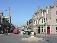
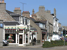
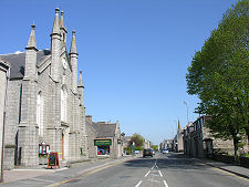
Close to the railway station is the focal point of Inverurie where the High Street broadens out into the Market Place. This has in its centre the small wooded park surrounding the war memorial. At the head of the Market Place is the large grey stone Town Hall, built in 1863. Since 1996 this municipal building has been joined in Inverurie by the new office block on the western side of the town that serves as offices of Aberdeenshire Council.
Today's Inverurie is surrounded by evidence left by those living here in the past. Besides the battlefields and The Bass referred to above, the ruins of the medieval Kinkell Church can be found to the south of the town; an excellent stone circle can be visited at East Aquhorthies, two miles west of Inverurie; and a remarkable Pictish symbol stone, the Brandsbutt Stone, today lives surrounded by a housing estate near the northern edge of Inverurie.
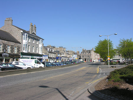 Looking towards the Market Place |

|
|
|
Visitor InformationView Location on MapWhat3Words Location: ///unheated.regret.port |
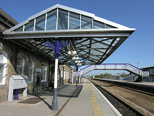 Inverurie Railway Station |
 High Street |
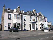 The Kintore Arms Hotel |
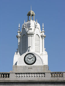 Town Hall Spire |